Huili Chen, Qiuhua Liang, Zhongyao Liang, Yong Liu, Tingyu Ren https://doi.org/10.1016/j.rse.2020.111868
Abstract
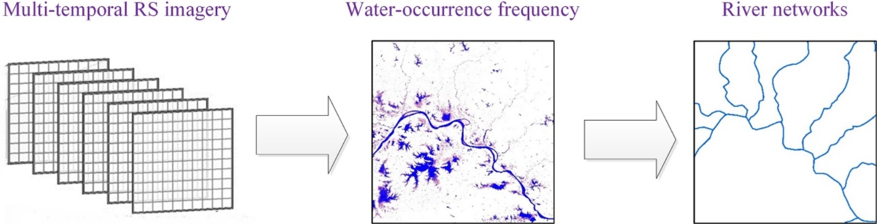
Precise delineation of river networks is important for accurate hydrological and flood modelling. Whilst remote sensing (RS) has showed great potential in monitoring hydrological changes over space and time, the existing RS-based methods extract river networks based on local morphologies and seldom take into account the overall hydrological connectivity of the rivers. The existing methods also commonly neglect the effect of seasonal variation of water surfaces and the existence of temporary water bodies, which deteriorate the precision of positioning river networks. To address these challenges, a new two-stage method is developed to Extract spatiotemporal variation of water surfaces based on Multi-temporal remote sensing Imagery and Delineate connected river networks with improved accuracy (EMID method for short) using a path tracking technique. The EMID method delineates connected river networks using (a) multi-temporal imagery and a Random Forest model to synoptically map the location and extent of water surfaces under different hydrological conditions, and (b) an optimization algorithm to find the best river paths based on water-occurrence frequency. Four drainage basins with various river morphologies are considered to validate EMID. Comparing with alternative methods, the EMID method consistently produces river network results with improved accuracy in terms of stream location, river coverage and network connectivity.